
Robert Perkowitz
Bob's Bike Tours
Robert Perkowitz
Bob's Bike Tours
Alpine TX 128.8m**
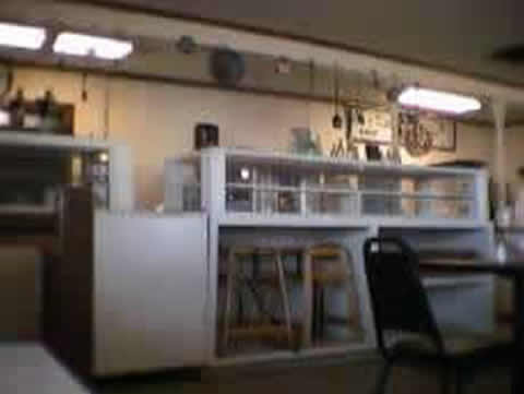
OK, Ill admit it. Im stalling. Its 9:25AM. I am in Papas Caf (seen better days) just south of the intersection of Interstate 10 and US90. Its still only 41 degrees. The westerly tailwind that helped me out of the valley, through the mountains and here, 33 miles, in 2-1/2 hours, is about to become a cold, difficult cross wind. The next town with a gas station is Marta, (pics to be inserted tonight), is 74 miles away. Im cold and hungry, but mainly cold and apprehensive about the wind. Ill be stocking up at the Pilot gas station next store before I leave. Heres what my computer camera is looking at now.
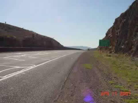
Feast your eyes. I took three pictures so far. 1) the road 10 miles outside of Sierra Blanca, looking west, back toward the town. Visibility had dropped to about 4 blocks yesterday. Its back to as far as the eye can see. 2) a sign announcing that Im in central standard time (out of Mountain), and 3) a view coming down out of the Quittman mountains.
Editors note: Only inserting the central standard time shot here to save on file size. Reducing resolution of most other shots also to save space for this low bandwidth planet. I also like this picture because its the start of a big downhill.
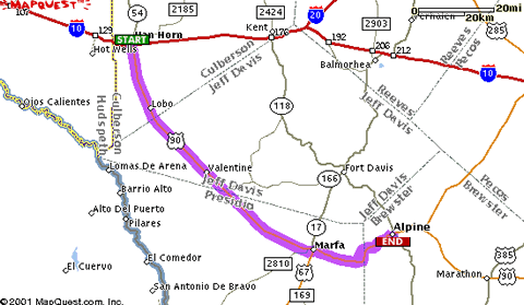
Whoops. Just got done with Papas Big Breakfast: 2 pancakes, 2 eggs, 2 bacon, 2 toast, hash browns. Need to stall a bit more. The next town with a known hotel is Alpine, 110 miles from here. Heres the map.
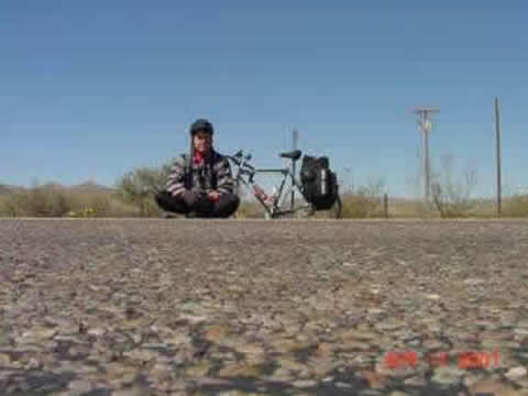
I put on all the clothes I have this morning, took some off cause of the heat build up in the climb, and now need to put them back on. Im considering staying on the 10 east to Kent, and then heading south on the 118. PROS: Thats the official Southern Tier bike route. I get to keep the tail wind. Known food in 40 miles or so at Kent. CONS: After 7 days on or next to Interstates, anything else would be fun. The wind might not die down. It might be longer, hillier. Doesnt look like much between Kent and Ft Davis.
These are the kinds of things you think about when youre riding a bike across the country. One last stall. Temperature. Its been like 40 (temperature) when I start out, but it usually warms up 10 degrees an hour or so until it gets to 80-88 by 12 or 1. For some reason its staying colder longer today. Shiver shiver.
End of stall, time to stock up on M&Ms with peanuts, gummi bears, extra 64 oz Gatorade (plus my two bottles), beef jerky, sunflower seeds, starburst, maybe a piece of fruit if they have it (not a lot of calories in them apples). Later.
*******************
Its now 10:28PM and Im in the Ramada in Alpine TX. The Alps of Texas.. They have a problem with hyperbole in this state.
I took US90 south. Solved the cold problem with a Mexican baja jacket purchased for $9.99, hood and all. Heavy and unaerodynamic, but warm was the priority,
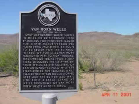
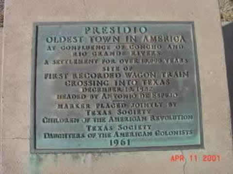
. 10 miles south of Van Horn, there was a historical marker. Not encouraging, but interesting.
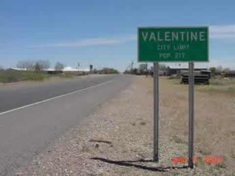
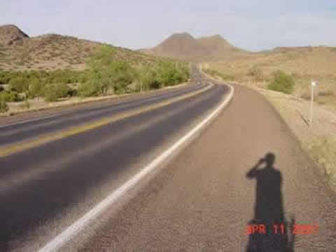
It was 74 miles of almost nothing to Marfa. There are two towns shown on the map before Marfa. Lobo simply doesnt exist. No buildings, no nothing. Valentine has no stores (looks like the caf closed in the 60s and the gas station in the 90s.
Saw buildings but not a single living (moving) thing in town. (There were homes that appeared inhabited, but this town is 36 miles or so from anything that sells anything.) I was very luck to have stocked up on liquid and munchies in Van Horn.
The words for these 74 miles are straight and flat. Heres a typical view.
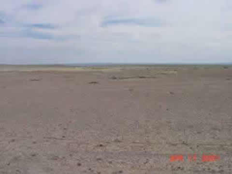
No farms, no nothing but grazing land. I could tell I was going uphill, flat or downhill by my speed vs. effort (11-12= uphill 13-15= flat, 16-17 downhill). Given the SW wind, not too bad, I averaged only about 14 mph for this stretch. Out in the middle of nowhere though, I did see this weird aircraft.
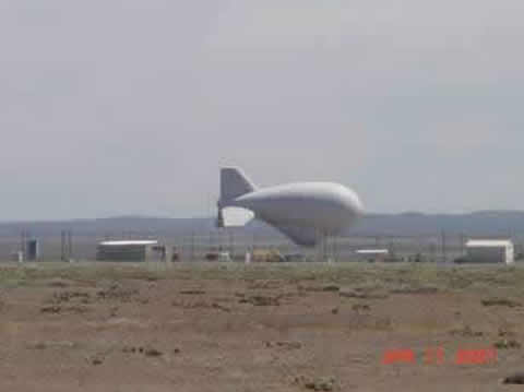
This is an Air Force Tethered Aerostat Radar Site (whatever that is). This blimp was huge. I contemplated it from more than 10 miles away. The only thing of interest.
Finally arrived at Marfa at 4:30 PM.
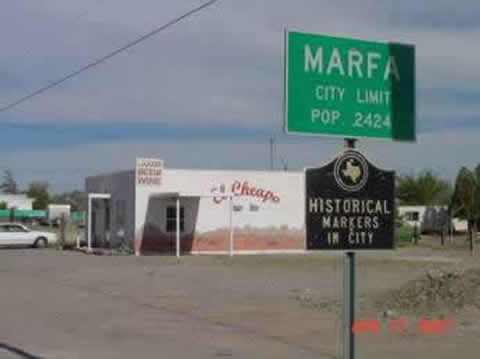
Didnt hit the El Cheapo liquor store, but had a late lunch at La Comida fresh market and deli. A lady in the parking lot there told me that Marfa was getting big city influences. They also had just opened a book store.
I quickly replenished and headed out of town after a half hour break. Up the Presidio Pass, into the Del Norte Mountains (these arent big mountains).
Major change of scenery. First naturally occurring trees in quantity Ive seen in days. Nice hills and views. Note
Note.. that there are no cars on US90. I dont know what they built this road for. Beautiful road, smooth, wide shoulders. Just no vehicles. I saw a car or truck maybe every 5 or 10 minutes going in either direction, and for variety rode in either lane, down the middle, whatever.
All in all, a rather dull day. Did cover good ground though, and I think Im a day ahead of schedule now, and have not used my off day, budgeted for Tucson. So Im 2 days ahead of schedule. Either my legs are getting stronger, or these mountains arent much. The next few days will be relatively dull too, I think.
| Cross Country Bike Ride | |||
| Route & Schedule | |||
| Date | Night | day | total |
| Mon Apr 2 | Oceanside, CA | ||
| Tue Apr 3 | Octotillo | 125 | 125 |
| Wed Apr 4 | Yuma AZ | 85 | 210 |
| Thu Apr 5 | Gila Bend | 128 | 338 |
| Casa Grande | 403 | ||
| Sat Apr 7 | Tucson | 138 | 476 |
| Sun Apr 8 | Wilcox AZ | 103 | 579 |
| Mon Apr 9 | lordsburg nm | 103 | 682 |
| Tue Apr 10 | las cruces | 126 | 808 |
| El Paso TX | 854 | ||
| Wed Apr 11 | ft hancock TX | 100 | 908 |
| Thu Apr 12 | van horn | 104 | 1012 |
| Fri Apr 13 | alpine TX | 110 | 1122 |
| Sat Apr 14 | sanderson TX | 86 | 1208 |
| Sun Apr 15 | del rio TX | 121 | 1329 |
| Mon Apr 16 | hondo TX | 118 | 1447 |
| San Antonio | |||
| Tue Apr 17 | gonzales TX | 114 | 1561 |
| Wed Apr 18 | houston TX | 140 | 1701 |
PS. I think my odometer (used in the top of the updates) is consistently reading 2-3% fewer miles than actual. Need to check this out on mile markers.
PS. Marta is Marfa. I just couldnt believe they would name anyplace Marfa and my brain converted it to Marta. Marfa is a real place.