
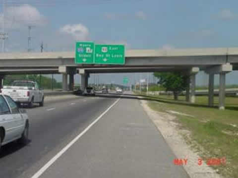
Slidell, LA 102.3m***
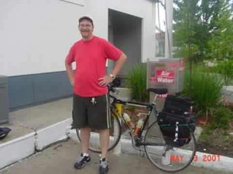
 May 2, 2001
Photo ops along the way are determined by uniqueness, importance, appearance, distance and time issues, and my then current mental state. I try to avoid repetitive shots. Coming out of Houma, for the first 35 miles or so until US90 met US310, it was pretty much the same old swamps and wind.
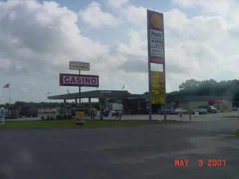
So, I thought Id show you a bit more of the local bayou culture. In most of the USA they combine highway gas stations with snack-oriented convenience stores. Here they combine some of them with Casinos, often with seedy lounges next door.. e.g.
And there are drive-thrus that brand themselves by drink type.
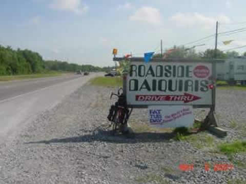
Now if youre thinking plastic cup with slush and maybe a tiny umbrella, think again.
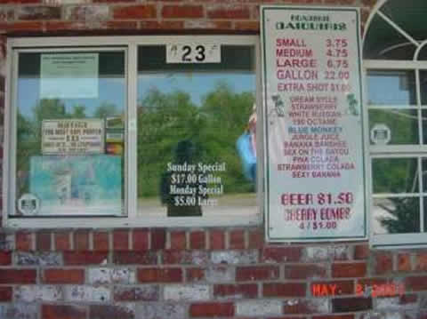
(See my reflection..)
Moving along 90, I was headed NE, so the ubiquitous 10-15 mph E wind didnt hit me head on. I was doing OK, but my front tire was slowly, slowly losing air. I changed the tube in Boutte LA, just before the 90/310 intersection, then headed straight east into the wind through Westwego to Gretna. This close to New Orleans, it was a divided highway with regular outcroppings of various commercial establishments.
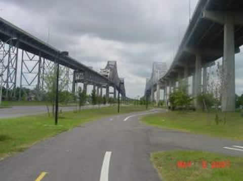
New Orleans was a concern. The allure and the wind made me want to stay. My mission (get across the USA) made me want to avoid it. Off to the side, I saw the big bridges that would take me there.

I stopped at the Shell at Charles de Gaulle and US90, and Christopher, the assistant manager and an avid biker, chatted me up.
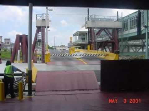
He said there was no way theyd let me cross those toll bridges. I hoped to take the ferry anyway, and he gave me directions, through a very marginal neighborhood (the projects) to a pretty bike path under the bridges that led to an embankment.
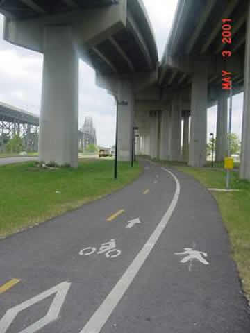
I carried my bike across a few sets of RR tracks, up the embankment and,
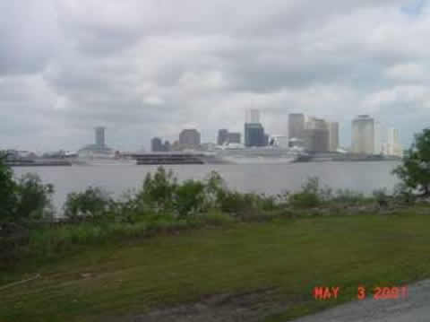
My first view of the Mississippi, and of New Orleans!! Milestones. Christopher also told me about the Jazz Festival last weekend and this. He said every hotel within 30 miles was booked solid. Hmmm..
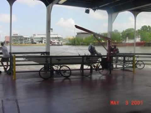
They held the ferry for me as I rode up, so I only got a shots from the boat, leaving the dock, of the ferry, and of the big river. Someones losing money on the ferry enterprise.
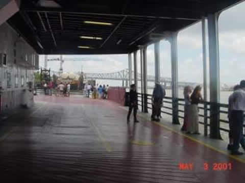
There are a lot of bikers in New Orleans. Overall though, the state is, by far, the least considerate of bikers that Ive been in. Traffic gives you little or no consideration. Theyve been much closer, much faster than anywhere. That aside, (this is around 2PM, 58 miles into the day) we docked on the other side.
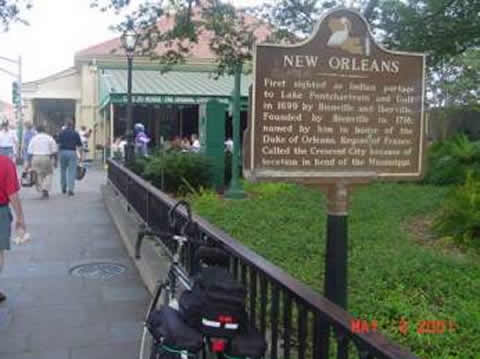
I rode along the river promenade. Lots of people and energy. Fun fun. Rode to Caf du Monde to see if it reopened after the fire, and get beignets. The definitive New Orleans Historical Marker was right in front.
I was planning to have lunch in the city, but it was so crowded I was uncomfortable leaving my bike more than a couple feet from me. Bourbon St.
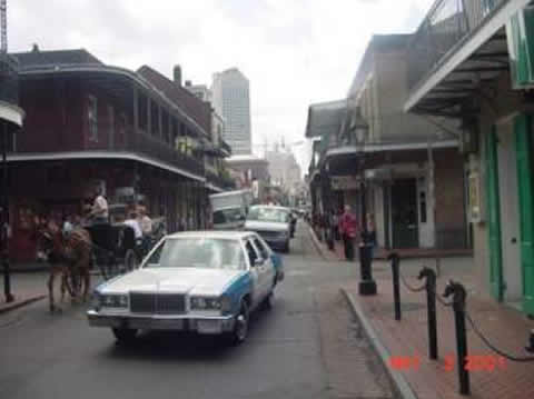
The bars are all loud and half full mid-afternoon on a Tuesday.
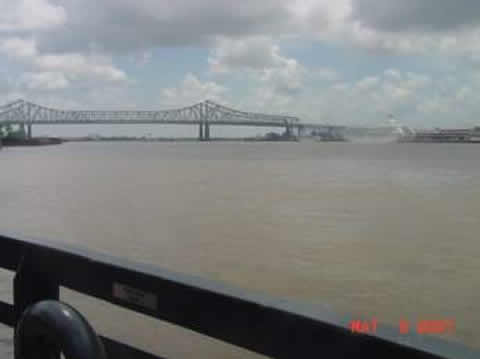
I took Broad Street (what they called US90 at that point) NE out of town and just before a big bridge ate lunch at a McDonalds :-(,
Ive been avoiding wind shots, but the headwind today was the worst yet.
Straight from the East. Only able to ride 8-10 mph in the aerobars (see the Caf du Monde photo). If it were not for the aerobars, I would be dead by now. Im in them 70% of the day, and the drop bars all the rest of the time. I forgot to mention it yesterday, but if you sit up, it costs you 2-3 mph.
Over lunch, I realized the days target, Waveland, 50 miles away, normally reachable, would be impossible. Made plans to head north off US90 onto US11 and stay in Slidell. At the decision point, I stopped at a Spur gas station (just ahead on the right) to reconsider.
Slidell was way off plan. A group of two truck drivers, the station manager, and some housewife told me that a) the causeway on 11 to Slidell was closed, b) I would be killed if I took the twin something or others (the US10 bridge, parallel to the US11 bridge), and that c) I need to go all the way around on US90, and then come back west to Slidell. They were very confident about b, so I actually took their advice.
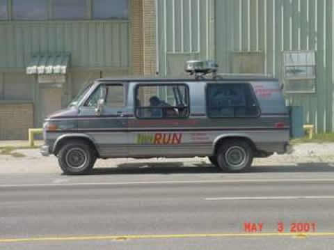
Heading slowly into the wind in the middle of Bayou Sauvage Wildlife Reserve (has lots of commercial buildings in it), I saw this van,
And low and behold, a few minutes later, this guy.
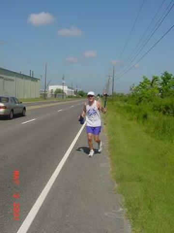
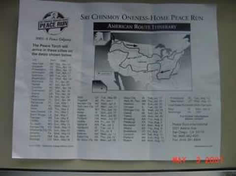
We took to chatting, the van came up, a couple of other runners came out, and we all compared notes. Peacerun.com – running through all 50 states to promote peace. They do 10 mile shifts, and go 30-40 miles a day. Heres a copy of the map they gave me.
A nice break (they were all Europeans). I didnt have time to pull out the camera fast enough, so he reenacted the run in the middle of our conversation for the photo op.
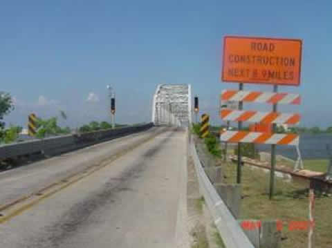
Then it was across a couple absolutely no shoulder bridges, through a lot of road construction, turn back west on 433, and into Slidell.
I was surprised to see that I made 102 miles for the day. Since I was supposed to go 119, youd think I was only a little behind. Actually, because I had to go back west a bit to get to a hotel that I could make it to today, I fell behind about 40 miles today.
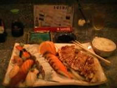
Checked into the Ramada. Sushi restaurant next store. The lady chef is the owner. Heres here and the $13.95 combo plate. Best sushi deal anywhere.

I havent checked the weather for tomorrow yet. So far, in every city from Houston to past New Orleans, every day, its been the same.
Thursday Daytime: A mix of clouds and sun. High 83. Winds E 10 to 15 mph.
Well see what happens tomorrow. Finally, in response to yesterdays question of the day – Whats an arpent?
arpent (r-p ![]()
![]() ) n.
) n.
Any of various French units of land measurement, especially one used in parts of Canada and the southern United States and equal to about 0.4 hectare (0.85 acre).
Now I know what the people in the bayou are selling when the sign says 40 arpents, call some phone number. Thank you Chuck and Claire.
bye
