
Del Rio, TX 126m***
 April 11, 2001
Yesterday was the first day I did exactly what was planned (the 2 to the 3). Today was the second (the 3 to the END). Theres really not much choice. The Adventure Cycling trip map indicated: East of Alpine the route follows US90, a two-lane road with wide shoulders. From Marathon to Sanderson, a stretch of 54 miles, there are no services. From Sanderson to Comstock, 89 miles, services are extremely limited. Carry plenty of water and food, and call ahead to confirm services in Dryden.
I took 23 pictures today. Left in darkness, got 20 miles to Dryden, where there were the extremely limited services. – a combo post office with a general merchandise store (90% empty)

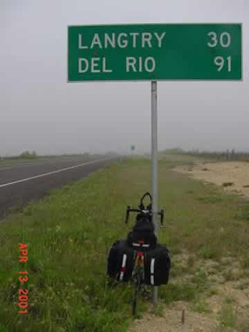
See the bike? The little old cowboy in this place (got yet another Gatorade, trying all the flavors, and a V8), pointed out a) that it was Friday the 13th, b) that there were lots of big hills I had to go through, and c) the record, as far as he knew, was some guy about 5 years ago who went from Marfa to Langtry (about 180 miles) in one day. He also told me it was going to rain. He was a very happy guy (really).
It went from dark to very overcast. 10 miles later, just before it started raining for 4 hours, I took this.
It was around 10 AM. Today was the first day I used no suntan lotion. I was reluctant to take out the camera in the rain, the visibility was bad, there was not much to see (I kept my head down, concentrating on the space about 15 feet in front of me, watching the drops fall from my helmet mud flap). By 1PM, 4 hours and 30 miles later, I came to what I assumed would be the only sights of the day.
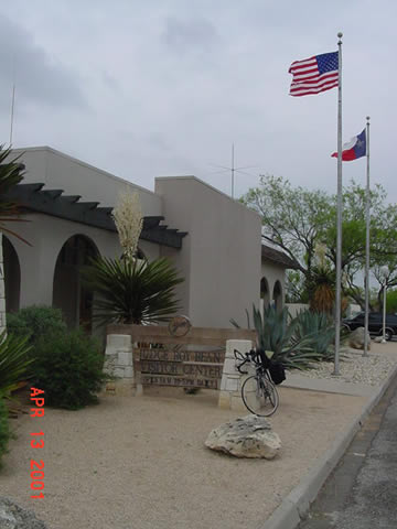

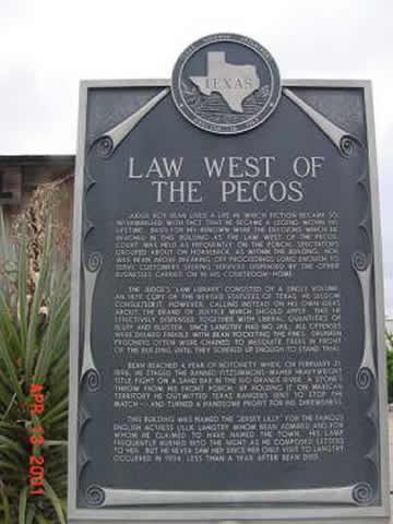
Initially disappointed by the modern visitors center, I found the actual saloon and plaque in back. (Almost passed this up as it was 1 mile S of the 90).
Then the rain stopped and the headwind started, and the hills got even worse. More hills today than on the whole trip. They cut the new US90 through a bunch of them, just making longer hills. You could see the old US90, and the even older pre-paved road route, snaking back and forth past the new US90 (new = about 40 years old). Heres new, old and pre-paved.
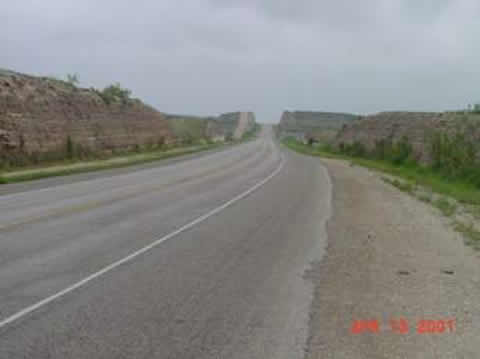
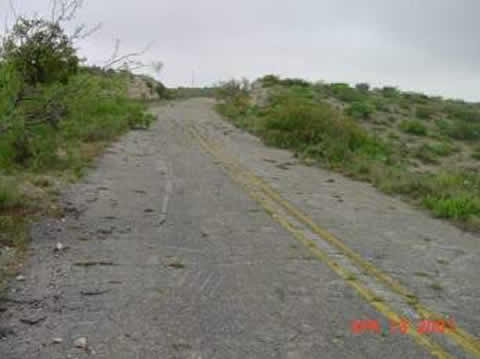

Ive been looking at old and new roads, and old and new RR tracks for days. Its interesting to see how technology and wealth straightens things out. (I know its kind of hard to make out the pre-paved road with this, or any other picture from the ground.)
Today was actually my worst day on the bike. I averaged only 10.5 mph, vs. a usual 13.5 to 14.5 and a best day of 16 (Willcox – Deming with Bryan). Rather fatigued and depressed, just before Comstock, when I was still 30 miles from Del Rio (5PM, 90 miles only), I came across this.
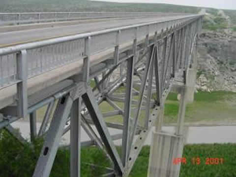
I wont use the F word here, but this was pretty scary. Hundreds of feet above the Pecos River, no shoulders whatsoever, cars zipping by at 70+. No choice though.

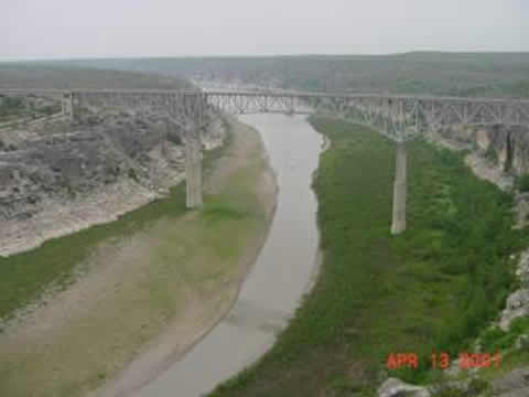
In the middle of the bridge I actually paused to take a picture. It doesnt come across well here, but this is looking south where the Pecos joins the Rio Grande. Thats Mexico, as it has been much of the day, off in the distance.
Loath to do anything but ride on, I couldnt help ride up to the rest/observation area to take this picture (looking N), and the one of the plaque.

(Not my hand, some tourist).
After this US90 turned a little south, helping with the headwind, and at about the rate of the Rio Grande going downstream, went downhill, through lesser but still significant hills. The only other thing left to see was Amistad Lake, and the big train bridge next to the road bridge.
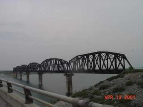
As you can see, it was getting dark. It was dark when I got to the Del Rio Ramada at around 8, my 4th day of riding into the evening. I amidst a multi-mile strip mall with lots of fast food, gas stations, booze stores, etc. – with stoplights.. the first time Ive seen any stoplight in about 4 days!
FYI, I am getting between 32 and 64 mpg. Bye.
