
Savannah 168.8m**
 May 10, 2001
This is almost the end – very almost. Im in Savannah, or was. Got to Bay Street (main road – historic district) at 8:30 PM in the dark. No available rooms. No Atlantic (saw the river next to Bay Street). Had to taxi out to the burbs. I need to a) figure out exactly where I am, b) find the Atlantic Ocean, ride to it, stick my foot in it, and c) slow down on the consumption, tomorrow. For today, a couple of themes.
First one – distance. Interestingly enough, my longest distance day was (planned the day before) the last day (today) and the second longest was the first. Today I did 168.8 miles. I could have done more. We will come back to this.
Theme two – consumption – for perspective: Get off bike breaks were at start (eggs, sausage, biscuit, gravy breakfast with OJ and milk, then next door for 32 oz Gatorade w/Revenge endurance mix, sunflower seeds); 39 miles (32 oz. Gatorade w/ another Revenge endurance mix, Peanut M&Ms); 66 miles (lunch: lb cheeseburger, fries, large Mountain Dew (for variety); 92 miles (32 oz. Gatorade, 32 oz water, $.50 gummi bears); 105 miles (20 oz apple/cranberry juice, Nestles Crunch Ice Cream Bar); 125 miles (32 oz gatorade, peanut M&Ms); 149 miles (pre-packaged ham and cheese sandwich, 16 oz milk, 24 oz Dasani water); 154 miles (flat tire). End of day: bananna, dinner at Pasticcio in Savannah: (carpaccio, pesto penne, Gavi dei Gaviwhite, Antinori chianti (2)).
My body has become adept at digesting lots of food quickly and it will take a couple days for it to calm down.
OK the day.
A supplemental goal for the RAAM trip was to set a personal distance record. Ive done 140+ miles a bunch of times, but never 150. Yesterdays update showed the reconfigured bike – no panniers, pregnant rack bag. That drag avoidance, plus favorable winds (at least minimal headwinds), plus time (early start) was the formula for 150 miles plus.
I blew the time thing at the outset. Didnt get on the road in Valdosta until 7:30A. The winds were nil in the morning, light and SE in the afternoon. Not a significant factor. I cruised at 16-19 mph. Where are the pictures? Vs these thousand words?

It was a fairly flat day. The first 20 miles were on 4 lane roads like this (8A). Note the RR tracks (planned). Today was about 60 miles of 4 lane, mostly with bad shoulders, unlike the absolutely god given perfect ones above. The rest was basic 2-lane.
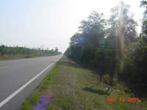
This photo is from about 24 miles into the day. Wiregrass Parkway (dont ask me why) is what Georgia calls US84 throughout the state. They persist in overtly destroying shoulders on 4 lanes, but leave them alone on 2-lane roads.
The first significant town I got to was Waycross, where I had lunch.

Nice sign.
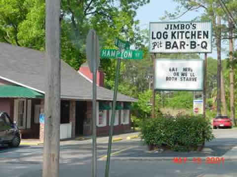
Theres not much to see in southern Georgia. I have photos of a plantation shutter company in rural Stockton, and of a restaurant in Homerville with the kind of sign that it ubiquitous in rural America, but which I have spared you from until this point.
Distance was my main point. At lunch:
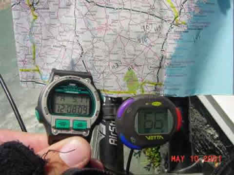
This is the map (H=hotel, #= distance from Valdosta, date (on watch) is one day ahead), and my instrument cluster.
Next report:

At this point the watch and odometer read:

Thats about 100 miles by about 2:30P. Farther on, I got off very heavily trafficked US84 on GA196. The home stretch.

Another theme of this day is forestry. The Georgia Department of, promotes it vigorously with the Idle Acres – Plant Trees and Trees = Jobs sign.
People plant them, and people cut them down. You can see the process in any stage all over southern Georgia.
Heres a regrown, but probably unplanted forest. Tall trees at the edge (leave them up for appearance), dense growth below. Planted forests have uniform pine trees, still with lots of undergrowth.

They grow, then they get cut down. Multiple methods: one is level the whole thing.

Another method is to slice out the pines (except some marked ones in this case) and leave the rest.

I cant explain the use of these methods, but theres an incredibly vigorous private forestry industry in Georgia. I went past many chipping operations, and dozens of trucks with logs passed me, in both directions, today.
I just keep on riding. Heres the end of the 20 mile run north on GA196, at US17, the last major road of this journey.

Next report ( sorry about the out of focus, Ive become overconfident about this Sony camera and computer – wonderful machines.)

As you can see, just before 7PM, 11.5 hours after start including breaks, I had 150 miles behind me. I was on a bridge over some RR trax, on US 17, just past Interstate 95, just outside Savannah. An Amtrack just happened to be going under the bridge at that moment.

Trailing a mail car, or maybe a luggage car. At this point I have some mixed emotions about this trip, which I may cover in the last installment tomorrow. But, just a couple miles later, my front tire hit something hard (how could I have missed it after such attention for so many miles?) and popped.

That makes two flats for the trip. I fixed it, and continued strongly into Savannah. Wheres the welcome sign? A big disappointment for both of us. On US17, heading into Savannah from the SW, there either isnt one, or I missed it. 🙁 Maybe Ill find it tomorrow.
But I rode on, into clearly what I imagined to be Savannah, as the day darkened. I cut straight east on US80, and then straight north to Bay Street on Bull Street (I dont name them, I ride them). At 8:30P, to document something in lieu of the Welcome to sign , I took a picture of this historical marker in some square, 3 blocks south of Bay Street.

This is pretty much in downtown Savannah. Historical markers are, I think unique.
So Im kind of here. I need to find the Atlantic tomorrow. Im done eating at convenience stores, however cheery.
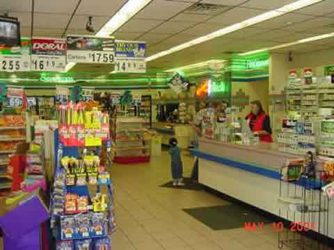
This one is from the 105 mile break.
Wrap up tomorrow.
