These updates usually end when I get to the destination town. At that point I need to a) find the grocery store, b) find accommodations and c) find dinner – quickly. Grocery stores (supplies for next day) close at 5:30P, and restaurants stop serving at 7:30 or 8. I write the updates at dinner. Some bits of information about the town need to go into the next day’s update.
I was soaked arriving in Kimba yesterday, so a hot shower and drying out my stuff (always packed in plastic to avoid dust and water, but everything still damp after hours of riding in the rain) were the priorities, after a) and b) above. I couldn’t call to check on Tom in the evening (8PM here is 4:30AM in LA), and I didn’t have a phone (i.e. online connection) so I prepared for an early start, and crashed.
(For those of you who are not getting the email updates (not registered), son Tom is in Hoag Hospital in Newport Beach with a ruptured appendix and some other complications – and likely to spend a couple of weeks there.)
Because Tom’s condition seems variable, I decided to try to head back to the USA SAP. It’s not as easy as it sounds. Leaving Kimba, two photographs. The giant parrot is the Great Galah, a local attraction. The other photograph is the town’s information bay.
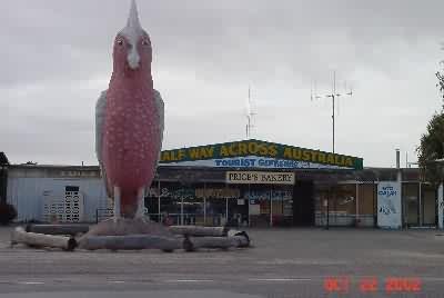
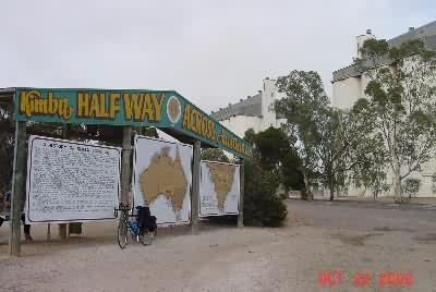
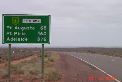
I almost always take multiple pictures of the information bays. They have history, geography, commerce and other tidbits of information. For instance, this one says the area was settled in 1908 for wheat production, in spite of very limited rainfall. The secondary purpose of the second picture is to show the wheat silos. They mark the towns and are visible from many kilometers away. Here’s the first mileage sign.
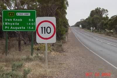
These distances, 86km to Iron Knob and 154 to Port Augusta are not impressive. I’ve been making 140km or so by noontime each day. If there was any kind of public transportation that would have gotten me out of these one-roadhouse towns (perhaps less than 100 people each), I might have taken it. Stuart Clement made an offer to drive out from Adelaide to get me, but that would have been a 10+ hour round trip for him, and I thought I’d get there almost as fast by riding to Port Augusta and taking some non-pedal powered transportation from there. In any case, as the Kimba information sign said, it was off into the undulating hills
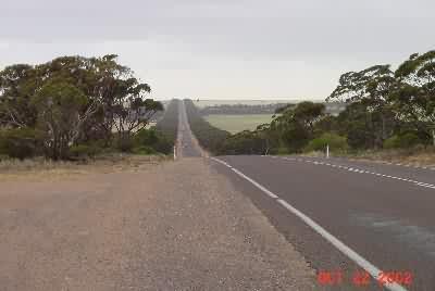
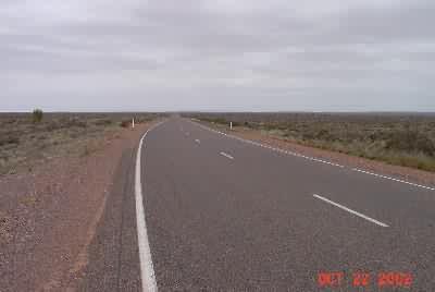
This looks like lush scenery along the 3-chain wide road, but when you’re alongside it the foliage is bushy topped with sticks underneath, so you get to see all the wheat fields. Then, for the first time since pre-Nundroo 3 days ago, the scenery changed.
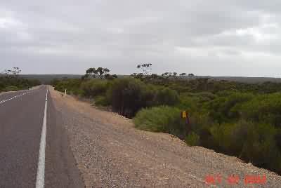
I had a welcome couple of hours riding through the Lake Giles Conservation Park. Green everywhere. No wheat or buildings. Then, when I came out on the other side, it was like I was back in the Nullarbor. There was a range of hills, one (only) of them badly mangled
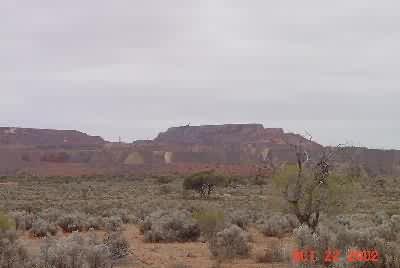
This hill marks Iron Knob, the only human habitation between Kimba and Port Augusta (except for a couple of farmhouses outside Kimba and something called Nuttbush Retreat (looks like a ranch converted into accommodation) north of Iron Knob.. Here’s Iron Knob’s local attractions sign and the image from which they get their image.
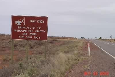
I took my first off the bike break here at the little Iron Knob roadhouse 1km south of the main road. There I learned that the mine closed in 1998, and the place became a mostly empty little town. They have a good sense of humor though. On the wall was a magazine article featuring the 6 worst places in Australia to go on holiday, featuring Iron Knob. They also sell t-shirts that say “Skip the foreplay, go straight for the Knob.” I went straight for Port Augusta. Here’s the mileage sign leaving town and a road shot that could have been taken in the Nullarbor, but was taken east of Iron Knob.
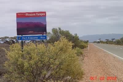
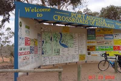
Highway Australia Alternate 1 rejoined Australia 1 (second major intersection in 1,500 km) 26 km west of Port Augusta. There were a variety of welcome signs to Augusta – this is the one with the pretty picture, and the information bay with the “Crossroads of Australia” designation, which Port Augusta deserves.
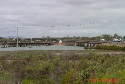
Then I crossed the Spencer Gulf on the new bridge, and started looking for a way to get to Adelaide.
I was unsuccessful finding any available public transportation to Adelaide. The last bus left at 1:30, just as I was learning about it 2 blocks away. The airport (5 km south of town) said they had a seat on the 4PM and my bike would fit, but when I rode there, it wouldn’t. There are no trains. I could have taken a taxi, but getting to Adelaide after 8PM just wouldn’t have been helpful, so I bought a ticket for the 6AM bus, and that’s what I’ll do.
(Oct 23, 7:20PM, Port Augusta)
– Australians have been buffeted by their own terrorist attack and maniac homicidal killers (2 incidents) in the past days. They’re talking about opening school days with the national anthem, having television programs to raise money for victims, increasing military spending, who knew what before the Bali incident, avoiding certain tourist destinations, etc.
– BIG GREETINGS TO Don Carse, his partner Lee, her daughter Cylie and especially to Alicia (Spagetti). It was nice talking to you at dinner in Kimba! I don’t know if the computer camera pictures came out, but if they did, I’ll send or post them.