Let me start with a diversion – this Japanese guy. He was heading west (!) and we passed somewhere between Penong and Ceduna, maybe 100km into my day. He was really well equipped, didn’t speak hardly a word of English, and was riding slowly into a good 15km+ headwind (my tailwind). After yesterday, he had all my sympathy and support.
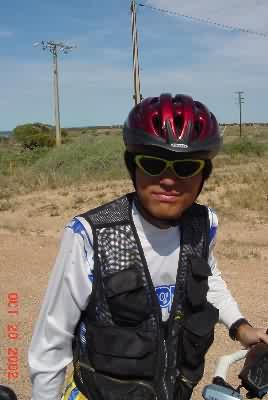
I have a shot of him in full regalia, but took this second shot, a close up, to show you the (insert favorite obscenity) flies. There are maybe 4 on his face, a few on his helmet and cloths, and the camera didn’t catch the 20 or 100 or however many buzzing around him, and me. They have been getting progressively worse, and I’ve had to develop a bunch of new techniques (fast stop, grab what you want, start riding again; quick photos, headnet for anything over a minute or so) to deal with them. My 15-second, 4-minute rule on flies has become 5-seconds and 1-minute. They make the days much less pleasant and relaxing… back to the story.
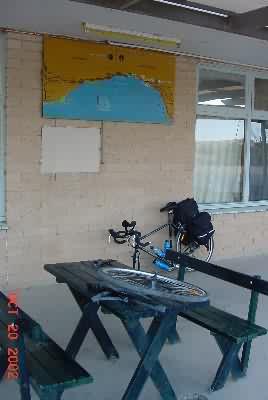
So, I’m packed up before bed and burst out of the hotel room at 6A, close the door (locked), and find I have a (another) flat front tire! I changed it relatively quickly at the tables in the front of the Nundroo Roadhouse, and was on the road by around 6:30A. This was my 4th flat, the thorn resistant tire. Air was leaking from the stem
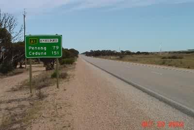
I was trying for a big mileage day to provide the option of going to Port Lincoln. The first mileage sign.
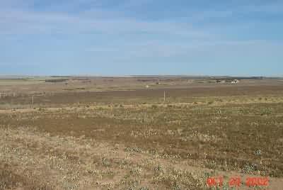
Ceduna was too close, and I had a choice of routes past it. I rode with an OK tailwind, averaging over 25kph, through some of the most boring terrain. Big empty fields, no animals, an occasional building.
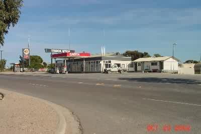
80km into the day I came to Penong. I missed or they didn’t have a welcome sign, but they had both a roadhouse and a general store, plus a few homes and a school. I restocked at the general store (first supplies at other than a roadhouse in 6 days), and continued. This was the last of the Nullarbor roadhouses.
Somewhere around noon, I came to Ceduna – pop. 3,800. You have to pass through a quarantine station before they let you in.
(SA Quarantine Station)
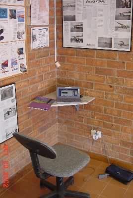
The town has banks, grocery stores (I got emotional walking through the produce section), a few gas stations, and maybe 15 other shops – including a sporting goods/bike shop that did NOT have another tube for me (could be a disaster if I get another flat, but I bought a patch kit and some DEET.). I took maybe 15 pictures of this town. Most of them are quite plain, but you appreciate things a lot more after a week in the outback. After buying a bunch of beverages and fruit (for some reason I restocked as if I had 200km of desert in front of me), it was off to the information center, where I asked about internet access and other information to help me make a route decision. They themselves had a little corner set up to plug into the internet! I took a break and sent one backlogged update (got to keep movin’ on).
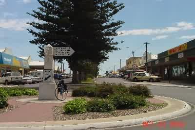
Here’s a picture of Ceduna’s main downtown intersection, the first roundabout since Esperance, I think, 1,400 km (840 miles) ago – still no stoplights or 4 lane roads.
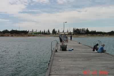
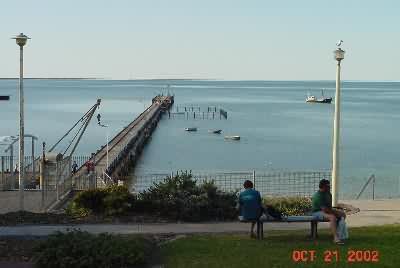
They had a pretty jetty – here’s the view of the town from the end of it.
They also had dozens of aboriginals milling about in small groups. I took a couple candid pictures of them… more comments at the end of the update. After lunch and an hour of milling about myself, I had to head out. This sign, just east of Ceduna, was my decision point.
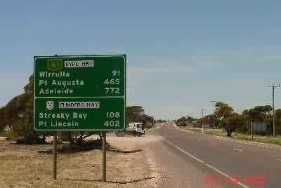
The choice was 772 boring but easy (?) miles to Adelaide, OR head up and down the Eyre Peninsula through Port Lincoln with an extra 300 km. After the Nullarbor and two half-days of farms (plus all the farms from Adelaide to Sydney) I decided to take the tourist route. No more dive-joint hotels, lack of attractive scenery and bad meals for me. If I don’t make it (4-1/2 days left, if I want a break in Adelaide before flying home, which I do), I just won’t come home. So it was off they Eyre Highway and onto the Flinders Highway for me.

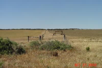
The Flinders Highway heading southeast was relatively flat, relatively straight, and almost completely non-descript. Very little traffic, maybe one car every 15 minutes. I still had an OK tailwind and progressed along at my 25kph pace. With the flies making it impossible to take any kind of reasonable break, I made good time to Streaky Bay. The sights along the way: fields, fallow or with wheat (no animals).
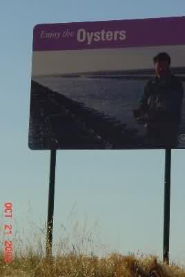
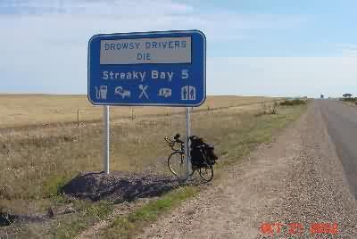
The State of South Australia also puts up these big, picturesque road signs letting you know what’s coming up. This area (Cedunda to Sneaky Bay) is famous for oyster farming, so…
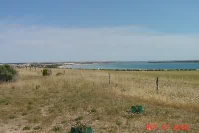
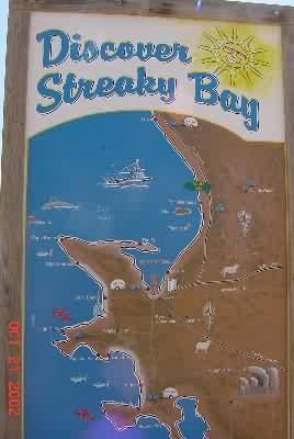
About 20km before Sneaky Bay, you could see the town across the bay. Here’s thsy view (again, 20km away, but I could see it) and the area sign (I’m at the green dot where it says “You are Here”, but I’m not sure if it even this comes across at the resolution this is coming across to you at).
Then it was the usual coming into town sign, which I refer to as the “welcome” signs.
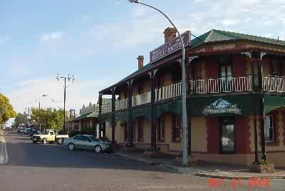
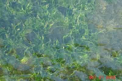
Finally, here are three Streaky Bay pictures. The first is of the hotel I’m at – the best since God knows when. The second is of the Sneaky Bay Jetty. Sneaky Bay, like Ceduna, is a historic town – a natural harbor (shallow hence the jetty) found by the Dutch 300 years ago and charted by Flinders maybe 200 years ago, named as such because someone thought the water looked “streaky”. Finally, a picture of the seaweed through that water near the end of the jetty (zoomed down) to demonstrate my delirium.
Tomorrow I want to, but probably won’t, make Port Lincoln – 300km away. It will take a good tail wind. Also, for my information, daylight has become more reasonable – from 6:00A to 7:30P vs. the 5:00A to 6:30P a few days ago.
(Oct 21, 9:01P, Sneaky Bay, SA, Australia)
Last night at (the dive joint) dinner in Nundro, there were a couple of guys at the table next to me who worked on the railroad signals on the tracks 100km north of the Eyre Highway. They were a wealth of interesting information, none of which I can attest to, but here it is:
– There seem to be very wide strips of natural vegetation along many of the highways in Australia, to what purpose? It can’t be reserved land for superhighways. By the time they get enough people for that, we’ll all be teleporting around. (See the Flinders Highway road shot above, plus a bunch of others on the site, for an example.) These guys said it came from the days when they made the roads “three chains wide” (they were not clear on how far “three chains wide” actually was) so they could drive cattle along the side of the roads – before trains and road trains (trucks).
– I asked about the aboriginals – why no photographs, etc. They said that aboriginal communities like Yalata were filthy – garbage (including nappys – their word, my spelling) piled around homes a meter or more high. In spite of lots of government money, they trash everything and don’t even take care of themselves. There are good communities and bad ones, but even on the good ones it takes 10 aborigines to do the work one “Australian” would. I obviously don’t know if this is the truth, the exception, or the rule – but whites staff the store and hotel at Yalata, and the aborigines I’ve seen are unkempt.
– Note: Itinerary, Section 3 has me going east, then south to Port Lincoln. 10,000 miles closer to this area then when I made the plan, I find it is much easier and better to stay along the coast, so the route is not quite right. For those of you who know what I’m talking about, I’m taking the Flinders Highway to Port Lincoln.