
Dauphin Is, AL 130m***
 May 3, 2001
Im not quite sure where I am on this map. Its Dauphin Island, AL, a 30 minute ferry ride west of somewhere west of Gulf Shores. Its probably just east of the #7.
I got a very early start (6:30A) to get a jump on the wind. It was about 8 miles back to US90 out of Slidell, LA, then 4 more until.
The morning sum is still low in the sky. The first thing I noticed about Mississippi were the generally poor shoulders on the road. When the cars are zipping by at 70 mph posted, 80 actual, shoulders are nice. In MS theyre either bad or not there at all (grass and stones).

Its kind of hard to tell from this picture. I usually remember to avoid taking pictures into the sun in the AM, which is why, if youve noticed, many morning pictures have been from where I had been, not where I was going.
At around 9:30, I made it to Waveland (26 miles) where I was supposed to spend the night. The wind was picking up, and I wanted to go more aerodynamic, so

Some traveling salesperson who realized that, throughout the south (so far), open doesnt really mean open, unless its lit up, sold jillions of the oval Open signs you see in this picture, all along my route. Im getting sick of them.
Though the name looks Spanish, the two barbers were Vietnam vets, familiar with Oceanside and every military base between there and Waveland. They (one of them) cut my hair too short, told me to buy a gun for a trip like this, shook my hand 3 times, and charged me $9 for his work. (He had rigged up a vacuum to his electric sheers to suck the hair off as he cut it, it worked pretty well.)
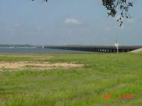
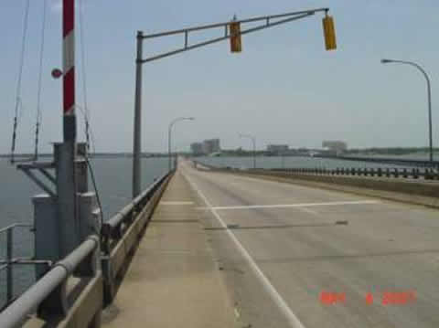
The theme of the day was bridges. I went into Bay St. Louis (next town), stocked up because my Louisiana map showed few towns far between in Mississippi, and crossed the first of maybe 5 causeways of the day (plus dozens of smaller bridges).
Looking back toward Bay St. Louis.
At this point, US90 went right along the beach, for about 40 miles. First town

Lots of pleasure and fishing boats. Yacht Club:-(
There was nothing to block the easterly wind, and I was reduced to 10mph, so I stopped at a gas station to look for alternate routes.

The lady said there were none, but I found that most of this 40 mile stretch had parallel roads inland (this is a strip of land 4 to many blocks wide between the ocean and the swamps). These roads had trees to block the wind. 50% less wind, 95% less traffic, fewer highlights, but 2x happier Bob.

Every few miles, the road would dead end and I had to go back to US90 for a bit. Passing through Gulf Port and Biloxi, there were lots of Casinos, hotels, etc. A Myrtle Beach in the making.

At 56 miles, at 1:00PM, I stopped at this restaurant in Biloxi and had dinner on the back patio.


Then I crossed the causeway heading out of Biloxi, and took a picture looking back at the casinos. It seems as though every building taller than 4 stories on the coast in Mississippi is a casino.
Then the road curved a little north, the wind shifted a little south, after Biloxi the road also went inland a bit, the commercial establishments disappeared, and I took off.
I never considered making Dauphin Island today, but after a couple of hours of 15+mph, the ferry at Dauphin Island (to Ft. Morgan) became a goal. I needed to cover 75 miles in 5 (at the time I thought 5-1/2) hours. So I didnt stop much.

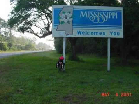
But of course, you have to stop at state lines. I was in Mississippi for only 81 miles. The rock behind my bike has a plaque marking the state border, and the cooperation in building what was then called the Jefferson Davis highway in 1928. The oldest plaque Ive seen.
And coming into Pescalouga (sp?) I saw this and didnt determine that it was a bridge in process until I got close.
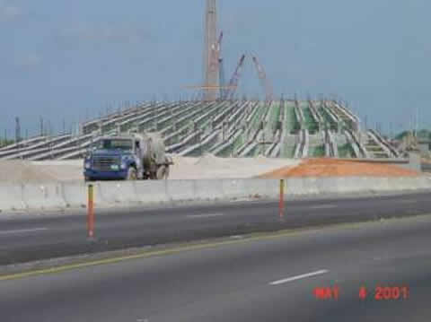
The newer they are, the bigger they are.
Just before Grand Bay, AL, I came across a huge section of the forest that had burned, and just after I came across another colorful cemetery (they all are here).

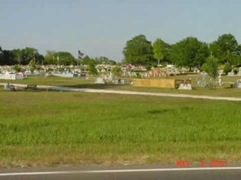
Flowers, flags, benches, statues, fences well decorated graves.
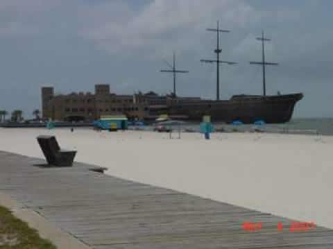
At 5:30 I learned that the last ferry was at 6:30, and it was 17 miles away. Heading back south, into the wind for perhaps 1/3rd the ride. I tried to make it anyway, and failed. It was really 20 miles away (the island was 17), and I would have been 3 minutes late anyway. I got to the ferry dock at 6:45, and it was gone. Across the street though was the location of Damn the torpedoes, full speed ahead. So I took a picture of that, found a motel, ate dinner, did this, and slept.

